The Arabahmet District
Nicosia, North Cyprus
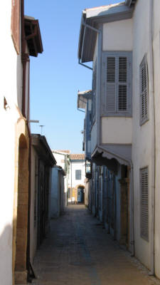 |
| An Arabahmet Street |
Arabahmet is a traditional residential neighbourhood in the western part of the walled city, to the north of the Paphos Gate. Most of the houses in the area were built in the late 19th and early 20th century as one or two story structures, with courtyards and gardens at the back.
As this area was one of the highest points of the old city, it was one of the most important districts of Nicosia, where many high officials and wealthy merchants chose to live. In order to adapt the buildings to their own culture, the Ottomans made several changes to the existing structures, like adding bay windows and building high garden walls. Recent restoration works have shown that many of the buildings in Arabahmet combine Ottoman, Venetian and Lusignan characteristics.
The main street in the centre of Arabahmet is Salahi Sevket was known as Victoria street in British times, and the name is still sometimes used. Here was the home of many British officials after 1878. Indeed, the houses here have a colonial feel to them with their ornate balconies that hang over their front doors.
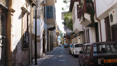 |
| Salahi Sevket Street (Victoria Street) |
Before the troubles, Arabahmet was the Armenian quarter of Nicosia, and had been since the tenth century. On the eastern edge of the area are the ruins of the Armenian church of Notre dame de Tyre. Originally a 14th century Benedictine monastery it was handed over to the Armenians as a reward for siding with the Ottomans. They were, however, expelled from the area in 1963 on the grounds that they had allied themselves with the Greek Cypriots.
After 1963, almost 90% of the population were Turkish Cypriots who had been expelled from their villages following Greek Cypriot attacks. After 1974, a good proportion of the inhabitants decided to return to rural villages, and by 1987, most of the remaining residents were elderly and of low income households. Buildings were becoming derelict and decayed, and the residential environment was deteriorating or giving way to workshops and warehouses.
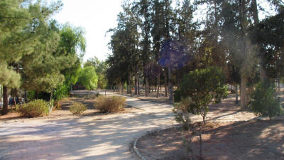 |
| The Roccas Bastion |
As part of the Nicosia Master Plan, the Arabahmet area is defined as a housing area, and is one of the few parts of the city that retains its original street pattern, urban fabric and architectural and environmental character. The aim of the rehabilitation project was to restore the buildings for residential use, and for community facilities including a library, a community centre, a small gallery, a folk dancing club, a small hotel and a restaurant.
As a result of this project, many former dilapidated buildings in the Arabahmet area have been privately restored as residences, small commercial ventures and cultural centres.
Immediately west of the Arabahmet area, is the Roccas Bastion, used as a public park. This is the closest point to the south. Here the buffer zone dwindles to nothing, and you can look over the city wall to the south, even having a conversation with the inhabitants.
Take time for a walk along Zahra Street, probably the most beautiful street in the walled city. It offers stunning views of the moat, the Ledra Palace Hotel and the romantic facades of the traditional buildings of the Arabahmet area.
See location in Google maps.
Back to Nicosia Index.